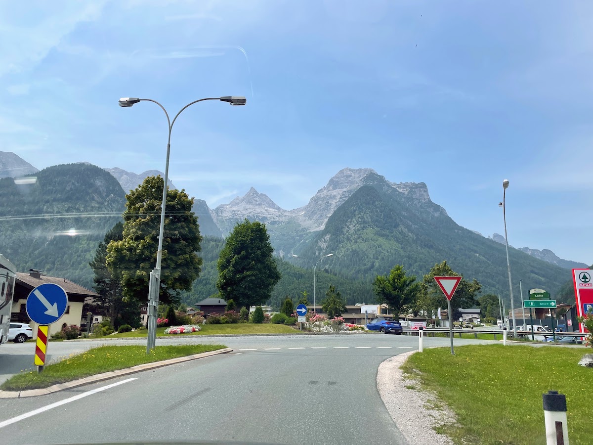
Photo from the car window. The mountains have already begun.
It took 2.5 hours to drive to the parking lot where the route begins. We parked for free, had a little snack, and set off! We started the ascent around 2 p.m.
Honestly, this was one of the most dangerous hikes we’ve ever taken in the mountains. But let me tell it from the beginning.
So, we were still living in Bavaria, in our little house. It was our third weekend there, our last full weekend (the following Saturday we were leaving our house in Bavaria). The weather was supposed to be good — warm and sunny. And I was hoping to go to the mountains once more.
As before, it wasn’t possible to find available spots in the mountain huts, and I had already planned a couple of day hikes for us. Volchiy suggested looking for huts a bit farther away. That’s how I found the Passauer Hütte mountain hut in Austria, and we were lucky again — I managed to book the last 2 spots.
On Saturday morning (as always, we fussed around and left an hour late), we set off.
Photo from the car window. The mountains have already begun.
It took 2.5 hours to drive to the parking lot where the route begins. We parked for free, had a little snack, and set off! We started the ascent around 2 p.m.
Start of the route. Adjusting my backpack :)
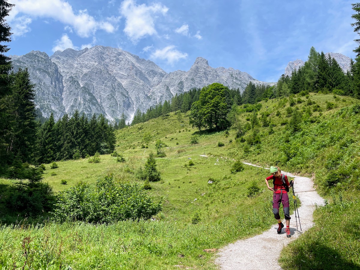
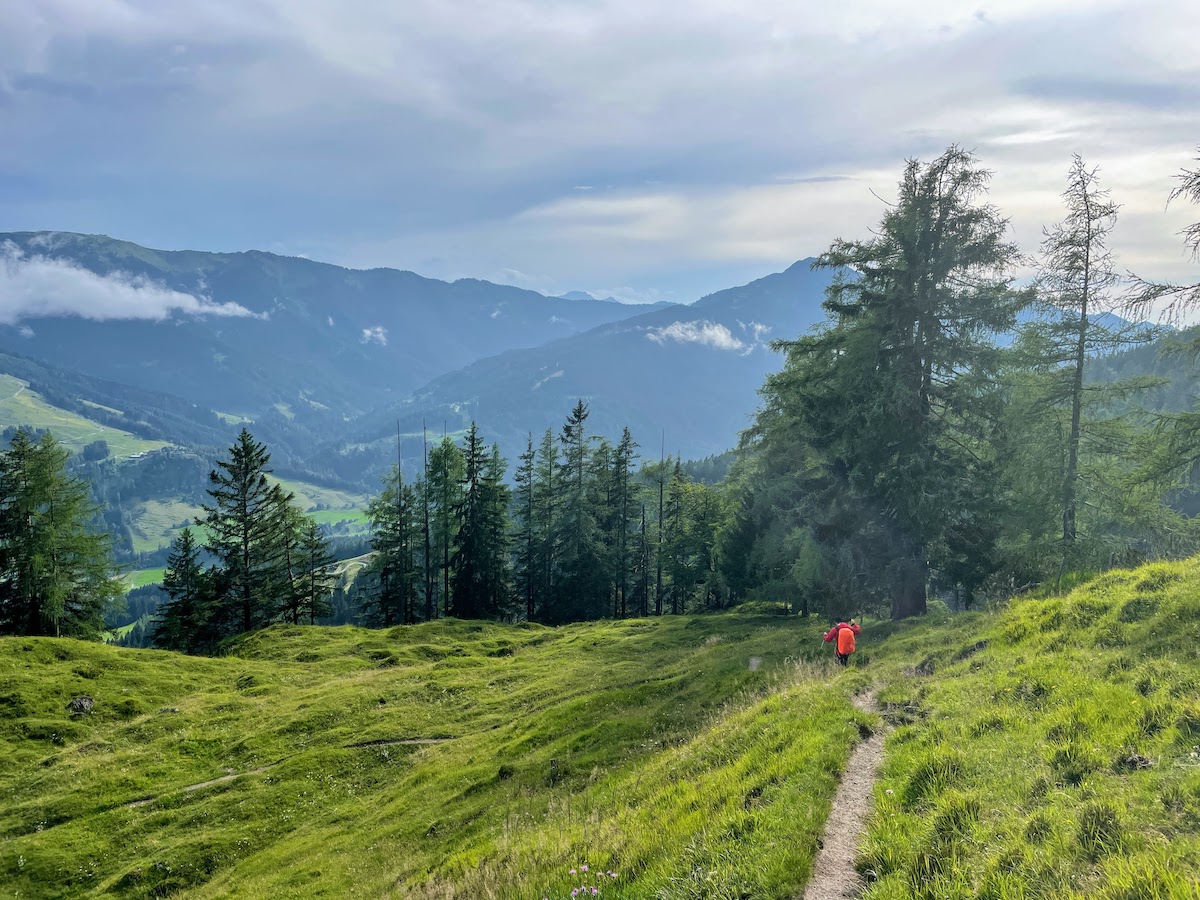
At first it was very hot, but soon a saving little forest began. The climb up usually takes 3-4 hours on average. The trail to the hut turned out to be very popular. As Volchiy said, it’s a “grandma’s route” - there were a lot of elderly people on the trail, and I’m very happy to see such athletic grandmas and grandpas; it gives hope.
Most of the people we met (and there were a looooot of them) were already heading back down. As we understood it, they go to the hut in the morning, have lunch there, and then descend. Along the entire trail there are many benches under the trees with beautiful views. We often stopped to sit and rest, so our ascent took 4.5 hours :)
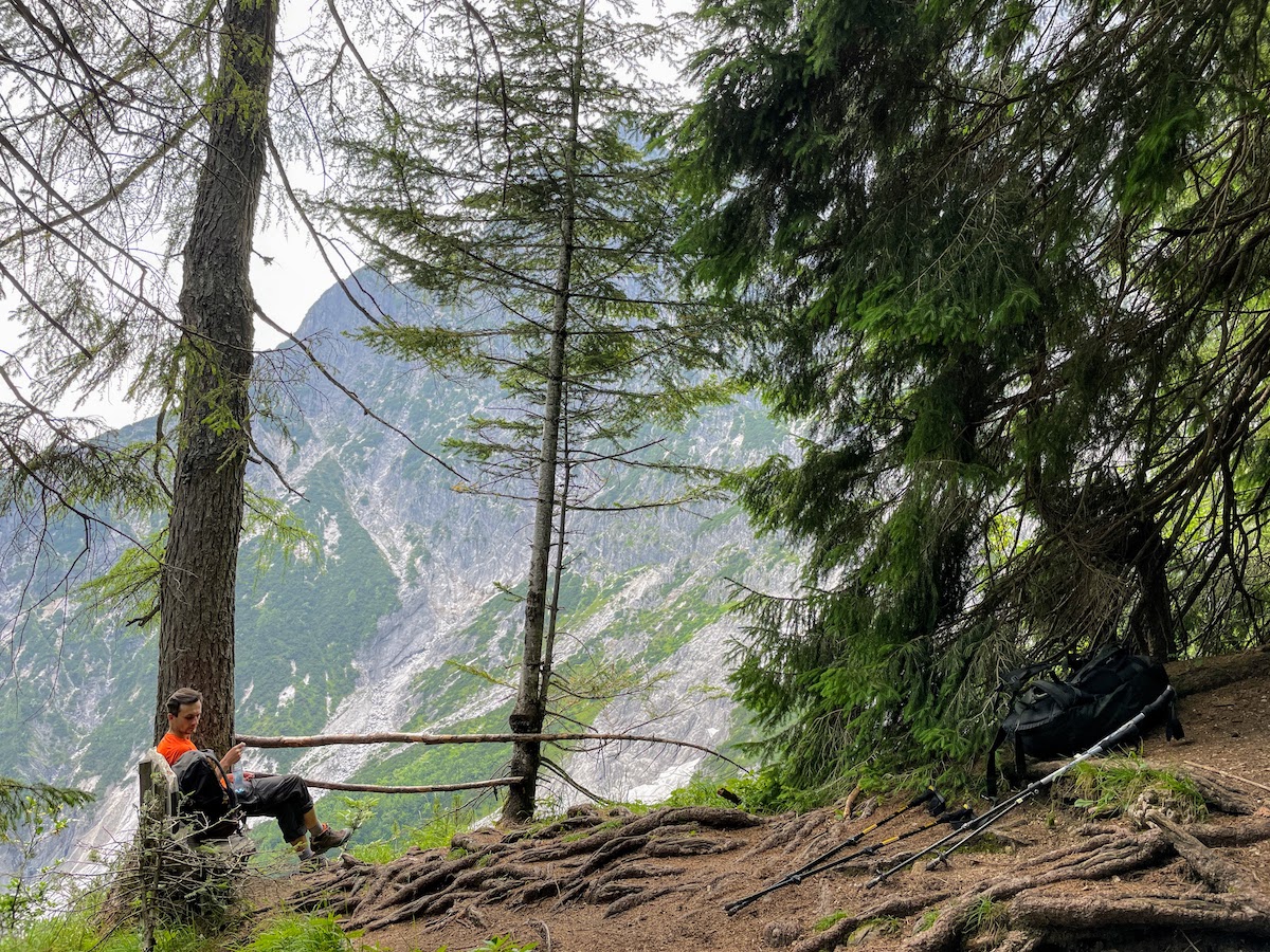
A bench with a view of the mountains — how could you not sit down?
Somewhere at an altitude of 1,600 meters, the forest ended and the trail began over lifeless rocks. At times, ropes were stretched along the trail, and in places convenient little steps had been made. Overall, the climb is indeed not very difficult (for those who are not afraid of heights) and very scenic. Perhaps that is why it is so popular.
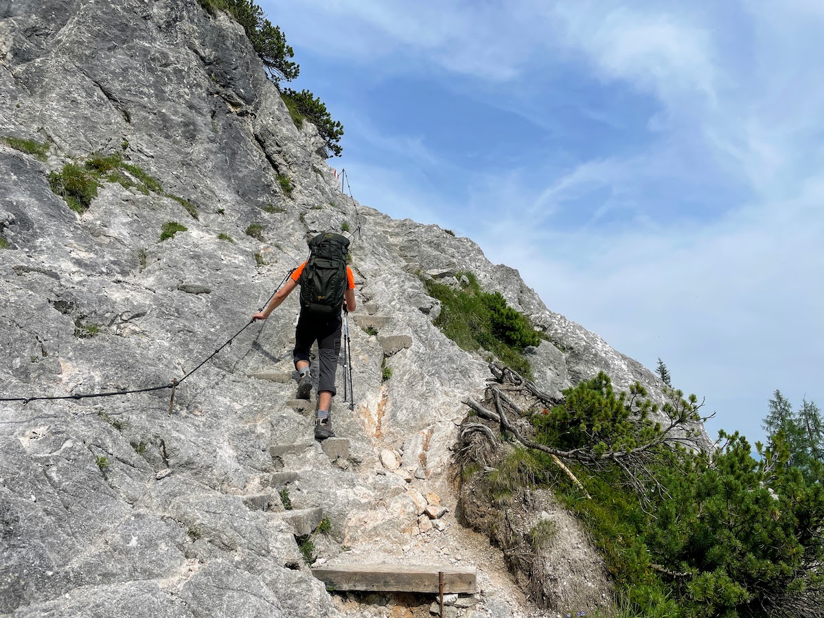
We’re climbing the little steps
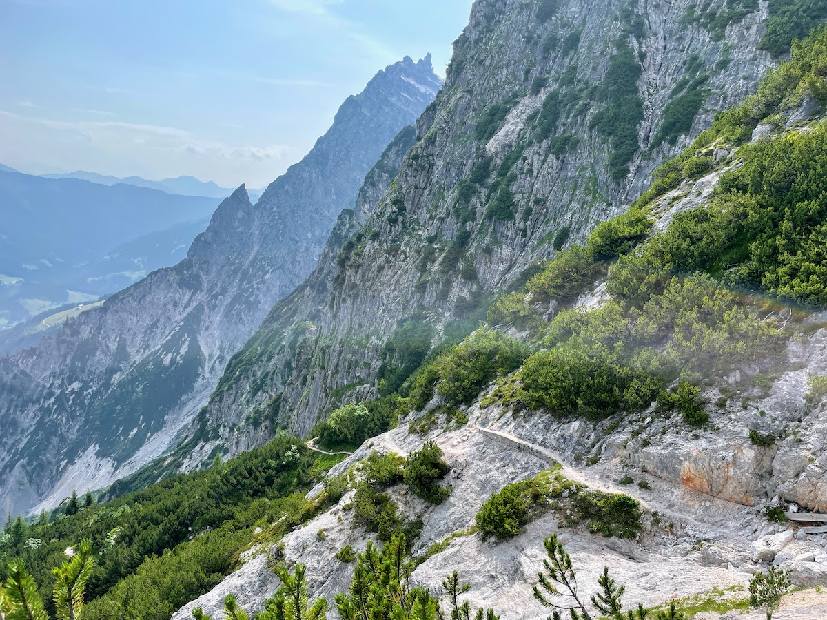
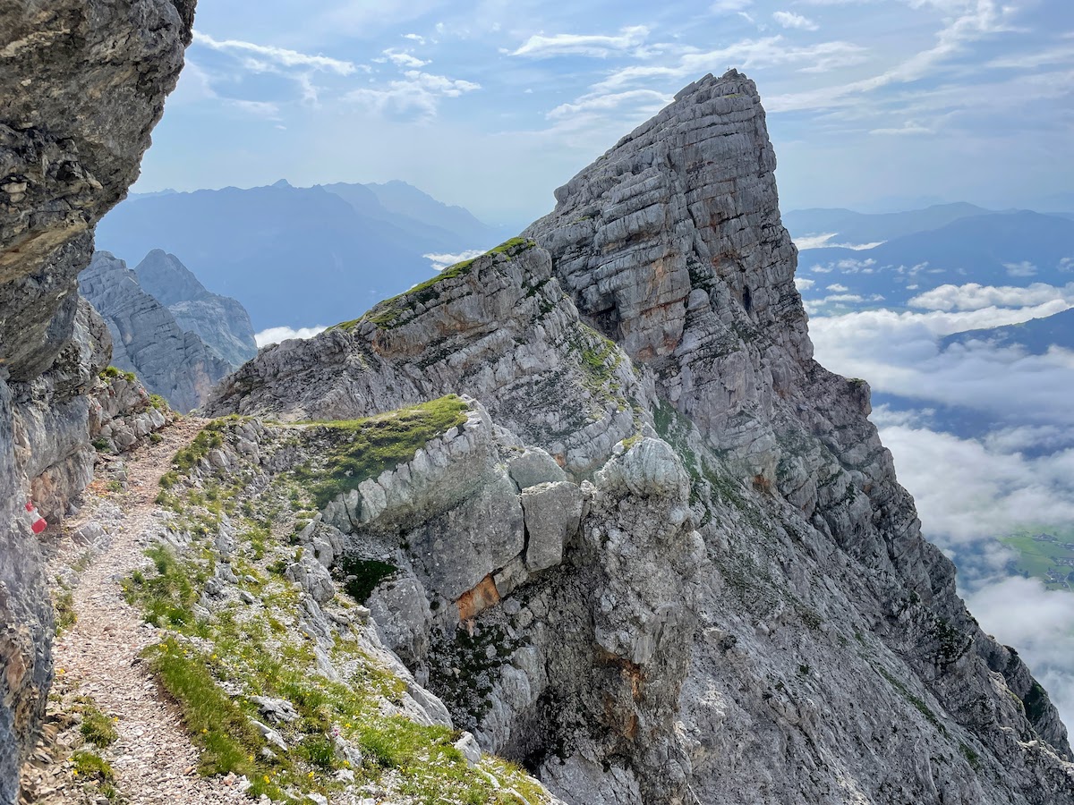
Path along the cliff
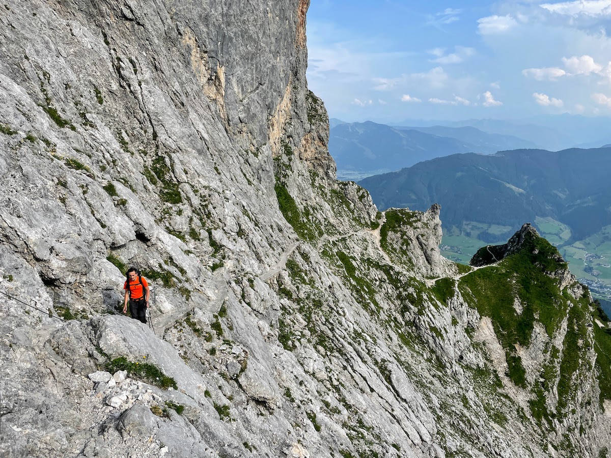
We’re almost home already
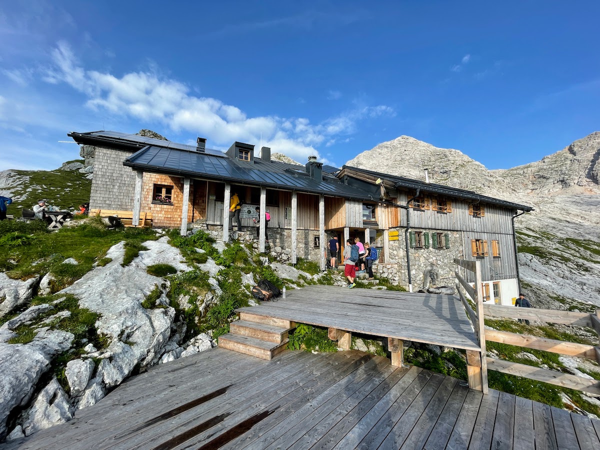
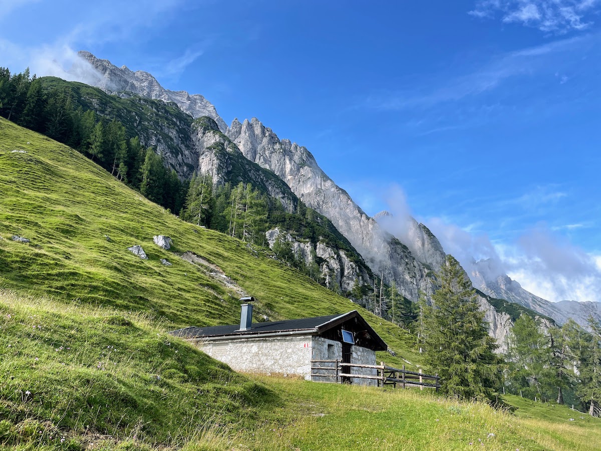
Passauer Hütte is located at an altitude of 2,051 meters above sea level. It is very well situated in a hollow between the mountains, with beautiful views. As Volchiy noted, “finally we are in the real mountains.” Indeed, thanks to the open terrain — mountains all around us in 360 degrees — it is absolutely delightful! Most often on hikes we either ascend into gorges or simply stay low relative to the other mountains, and the mountain peaks are only visible somewhere far away on the horizon. But here they are — all of them, right in front of us!
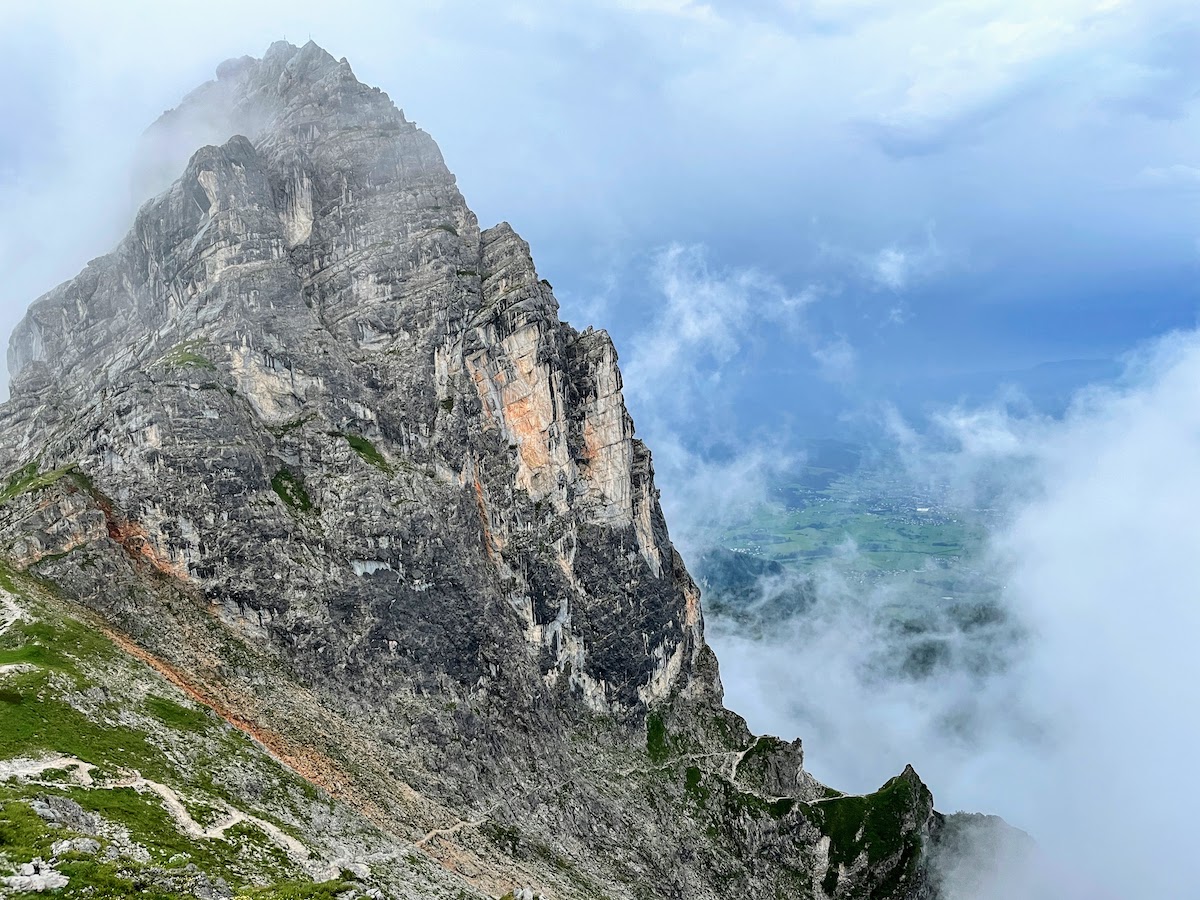
Mitterhorn Mountain. You can see the path to the house that we walked along.
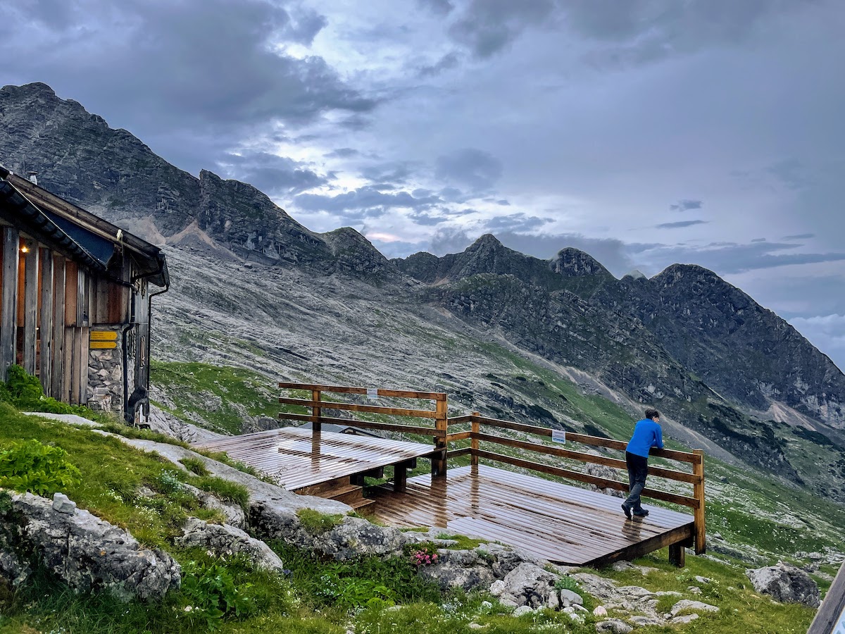
View from the terrace near the house of the mountains
We were going to have our traditional sandwiches for dinner, the ingredients for which we had carried ourselves специально. But the cabin smelled so delicious of the upcoming dinner that we decided to treat ourselves to dinner there - warm, tasty food. For dinner there was a traditional Bavarian dish (as the “host” of the house told us) - pieces of (probably roasted) pork with dumplings. It was very, very tasty! The dumplings were magnificent, especially with the gravy.
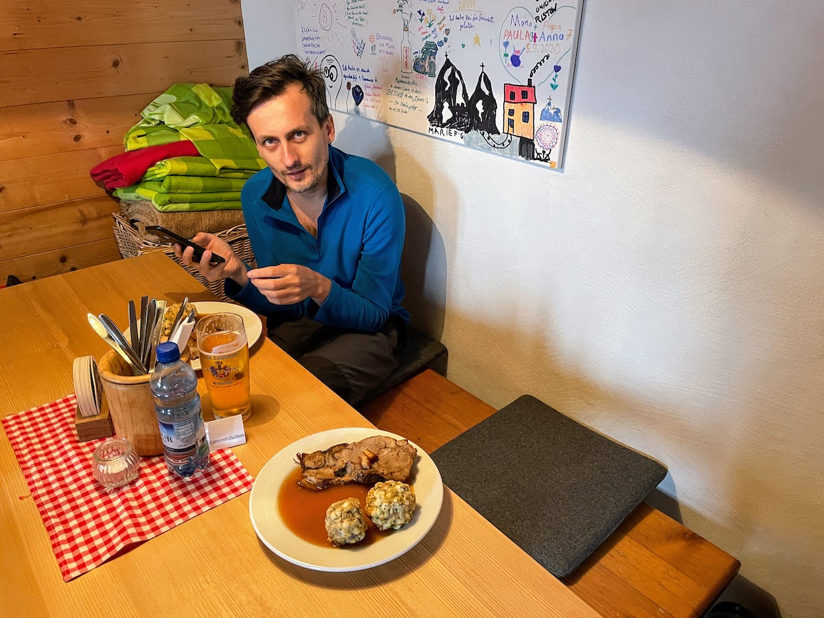
Our dinner, pork and dumplings in the form of balls
Unfortunately, the idyll of dinner was disrupted by the fact that two guys and a girl sat down next to us. The guys were from Minsk, and the girl was from Rivne. They live and work in Stuttgart. It was their first time in the mountains. For some reason, we didn’t like them very much. We finished our magnificent dinner and went to our “room”.
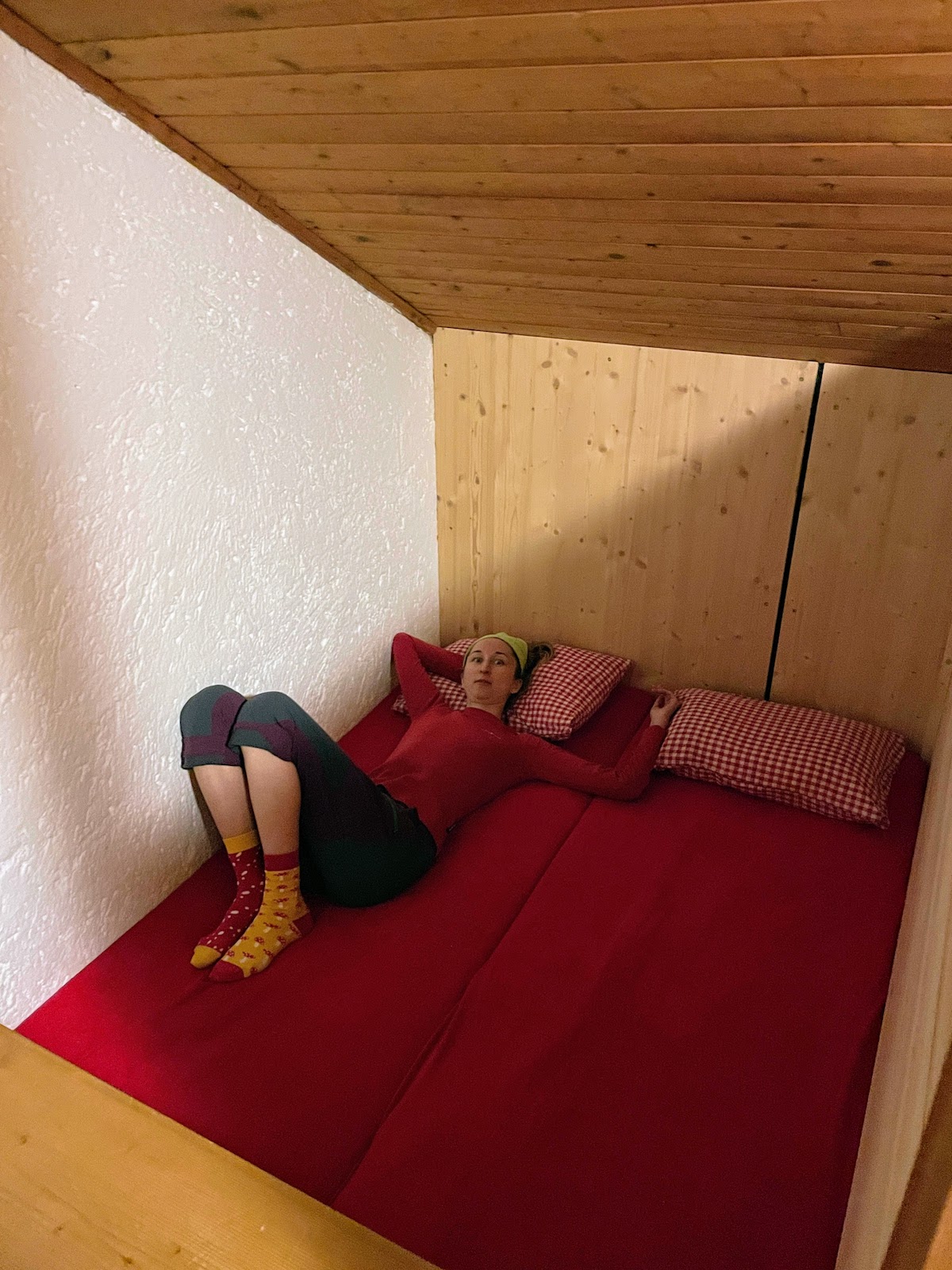
Our place to sleep
In the evening, a real storm began — thunder, lightning, and a downpour. It was so nice to lie in the hut and listen to the wind and rain rustling outside the walls.
Life in the hut was in full swing — people were drinking beer in the canteen and chatting. And we boiled water on the stove and made tea. We sat at the staff table, drinking tea with cookies. Pleasant music was coming from the kitchen, even Pink Floyd’s “Wish You Were Here”… You could hear someone in the kitchen singing along with David Gilmour, and then women’s laughter, the sound of water and dishes — apparently the staff was cleaning up after dinner. I was struck by these women who live here in the hut, high in the mountains, cook food, wash dishes, sing along to Pink Floyd and laugh… They were smiling, and it was clear that they were happy.
Morning. Thank you, home.
Sleeping in the hut was good, but it was stuffy and a bit noisy. We got a room in the passageway without windows (probably because we arrived last again :). Early in the morning people started walking back and forth, but we still managed to rest well. We were very pleased with the sun and the almost cloudless sky. We got ready, paid for the overnight stay and food, and moved on. Our plan was to go a little farther up the trail and have breakfast. And then the ascent of Birnhorn mountain awaited us.
On the way to breakfast. View of the house and Mitterhorn mountain
For breakfast, we found a great little clearing. After a hearty breakfast (sandwiches with tea :) we were ready to keep going.
Preparing breakfast
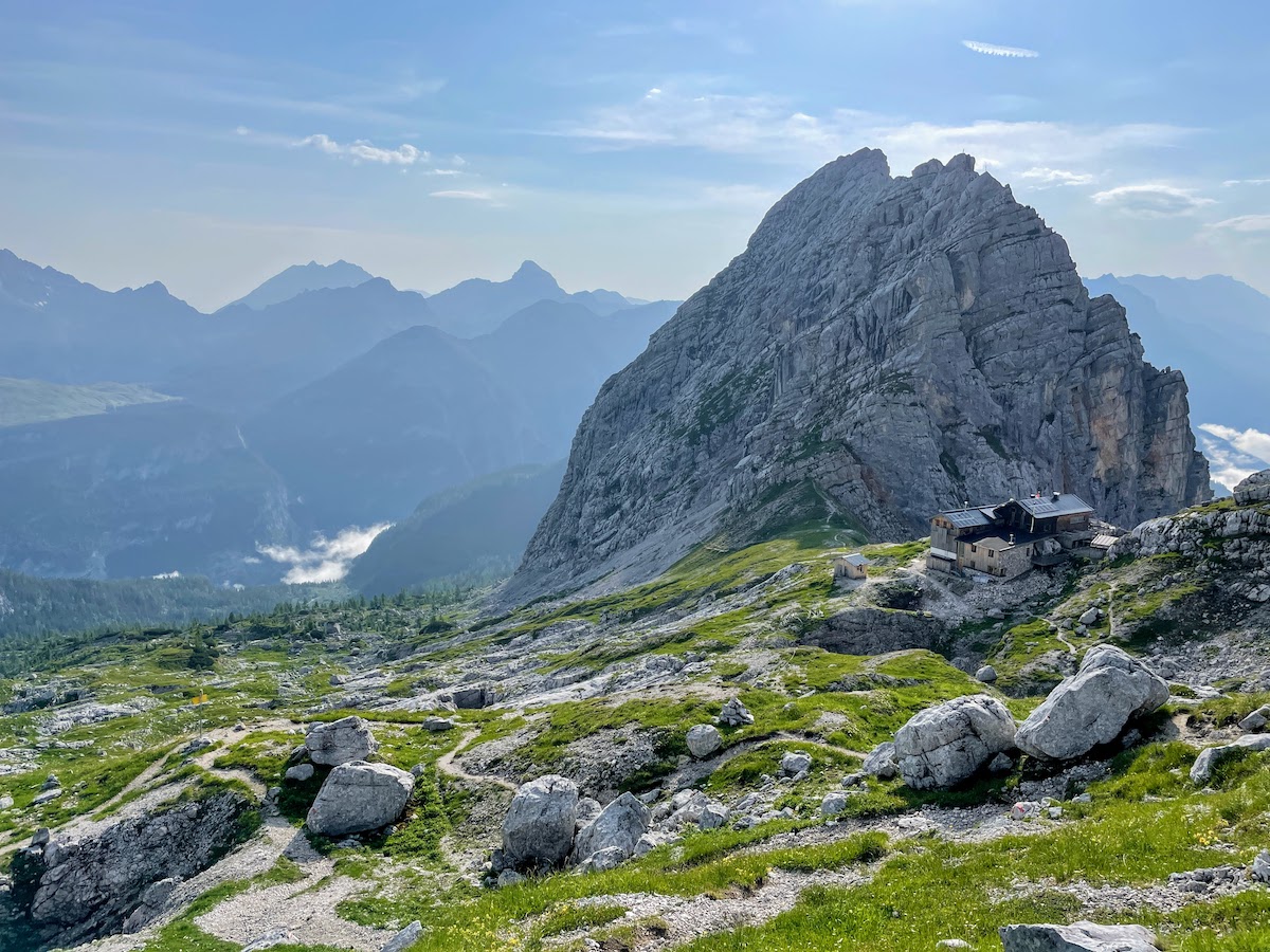
There are two trails leading to Birnhorn — from the north and from the south. There is little information online about the condition of these trails; I read that the northern trail is a little easier, but the southern trail is more popular because it passes through the Melkerloch cave. We chose to ascend via the southern trail.
Trail with a view of Mount Hochzint, we had breakfast at its foot
At first, everything was great. After breakfast, we got to the Melkerloch cave fairly quickly.
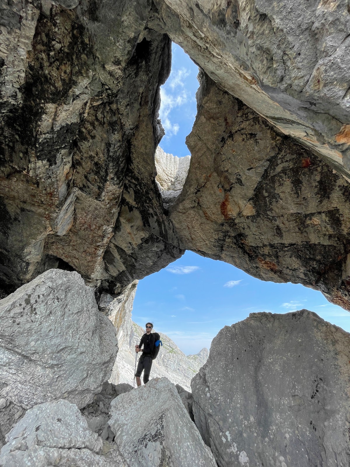
Wolf in the Melkerloch Cave
It’s not very clear from the photo what Melkerloch is like. It looks like a huge cave with a window to the sky. After Melkerloch, patches of snow appeared on the trail.
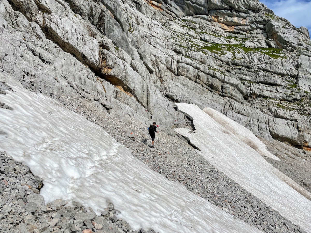
Crossing the snowy patches
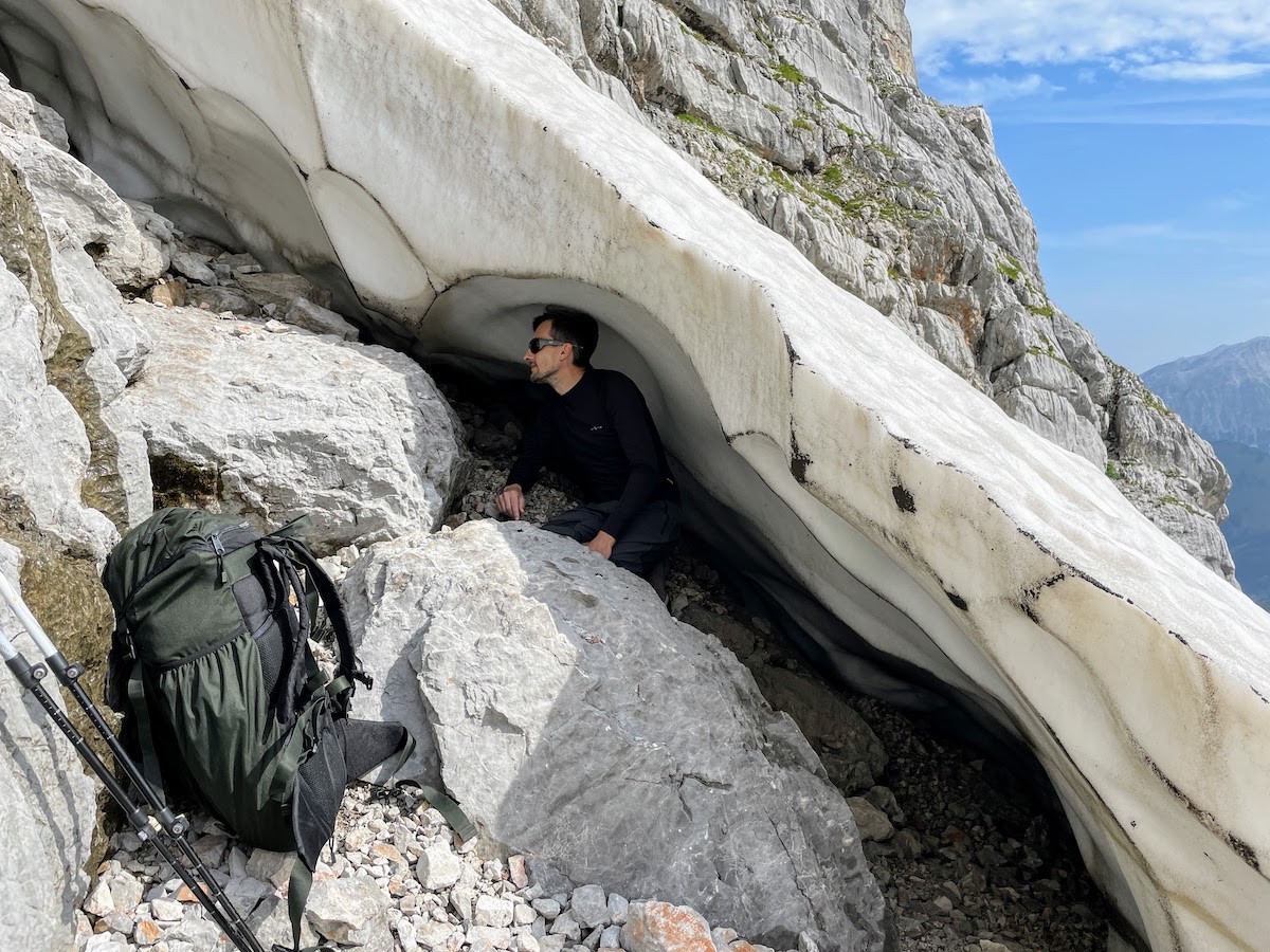
Wolf in a Snowy House
Then the ascent became steeper and steeper. Unfortunately, there were no support ropes at all here. Although the markers along the entire route were new. Also, round marks were sometimes found in the rocks, apparently from old pitons. We never understood it — perhaps the old safety ropes had been removed and they wanted to hang new ones? But why then did the owner of the house not warn us about this, why did he not suggest that it would be better to take the northern trail? I told him that we wanted to climb Birnhorn…. All of this remained a mystery.
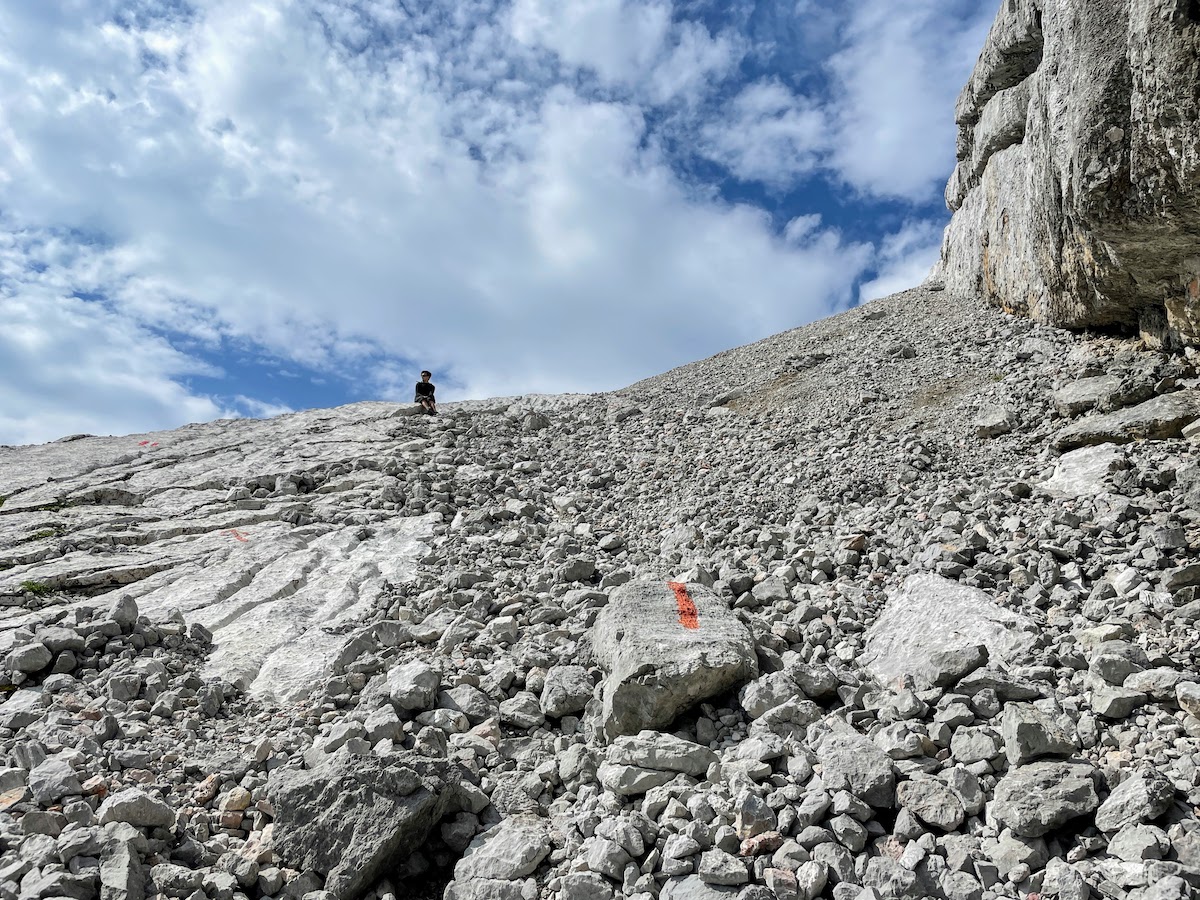
The trail is still in decent condition. There is a red marker on the trail.
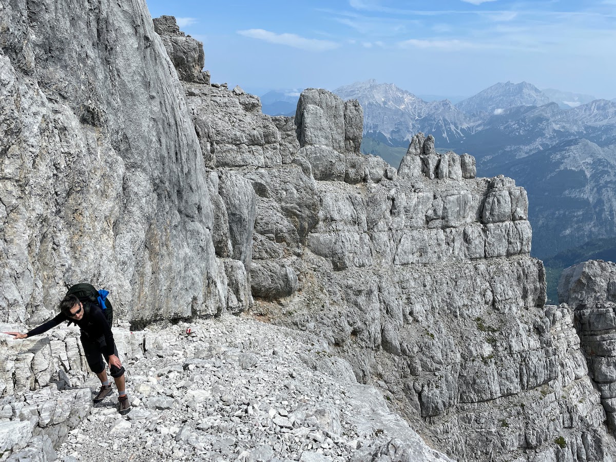
Meanwhile, we were climbing up the cliff. At times it was truly scary, and here some safety ropes would really have been useful (the kind that were strung along other trails in places a hundred times easier)…. I definitely wouldn’t have managed here without Volchy’s help. Many times he stopped and belayed me.
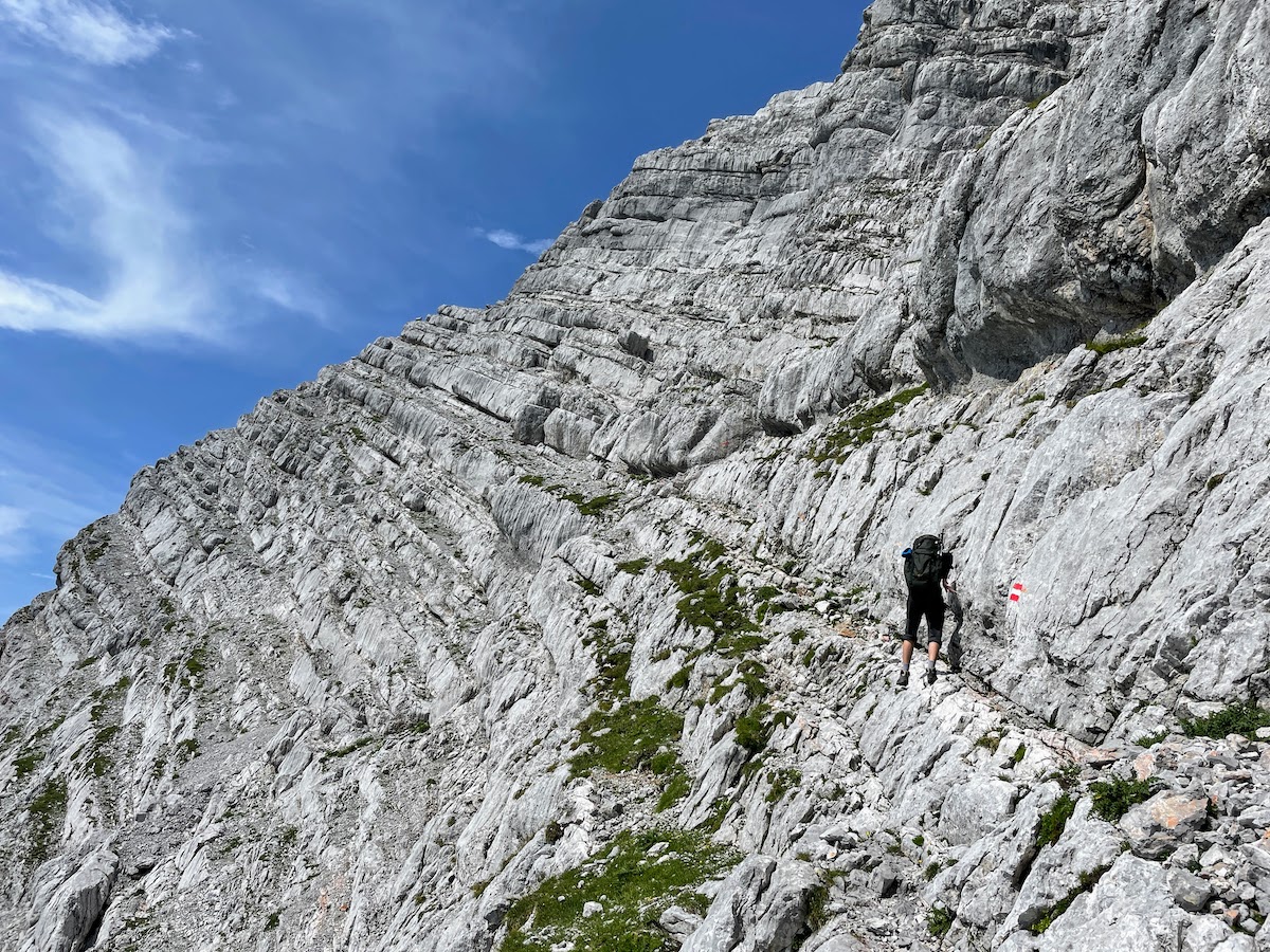
There are no photos of the scariest places for obvious reasons :) We’re climbing along the cliff.
Besides everything else, it was clear that getting back would be even more problematic; we practically had no choice but to somehow climb up. In such cases, going down is even more dangerous than going up.
Almost there. Sheer cliffs behind us. We’ve finally reached the summit.
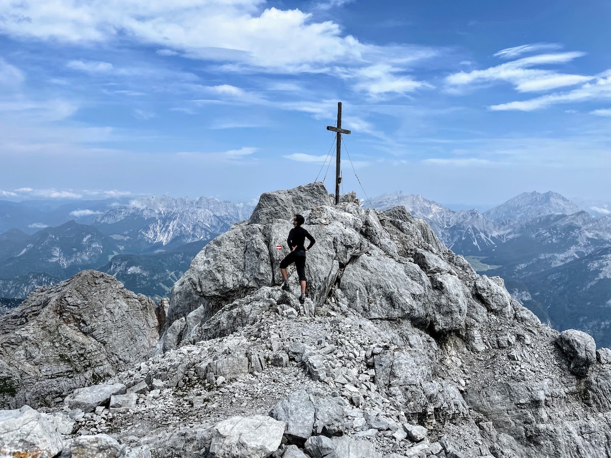
The summit is crowned with a cross. Below us lies a rocky plateau with patches of snow. We could see tiny black figures running across the snow — mountain goats.
I’m at the summit. The plateau with patches of snow is visible.
How nice it would have been to have a snack with tea here at the summit — but we had very little water with us. It was almost all gone — after the long, exhausting climb, we were constantly thirsty. So we sat for a while, caught our breath, and continued on our way.
After reaching the summit, a long, long descent awaited us. First, a steep descent down the north side of the mountain (safety ropes had already been fixed here, hooray!)
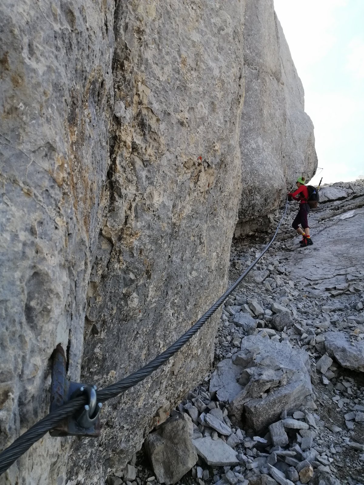
Descent from the other, northern side. Thanks for the safety ropes!
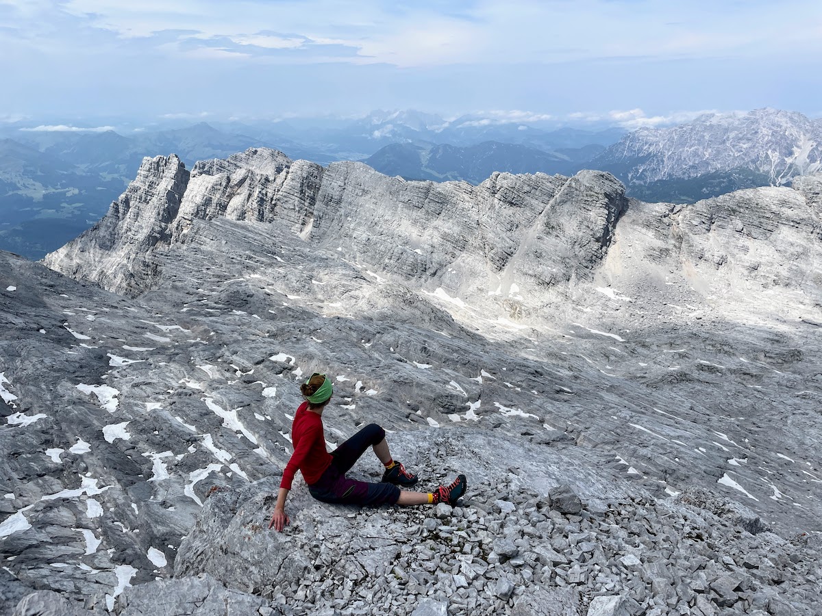
Then we turned onto the very stone plateau we had seen from the summit. A long, almost gentle route across the plateau; on the snow there were fresh tracks of the animals we had seen from above.
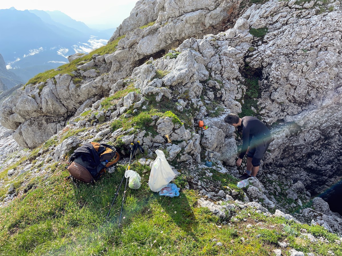
After the plateau came a long, drawn-out descent over loose scree; we walked slowly, steadily. Once again, Volchiy often helped me, but here it was already completely unscary, we just had to move unhurriedly. Our strength was running out. The water was almost gone. But fortunately, on the way we came across a stream where we filled our bottles.
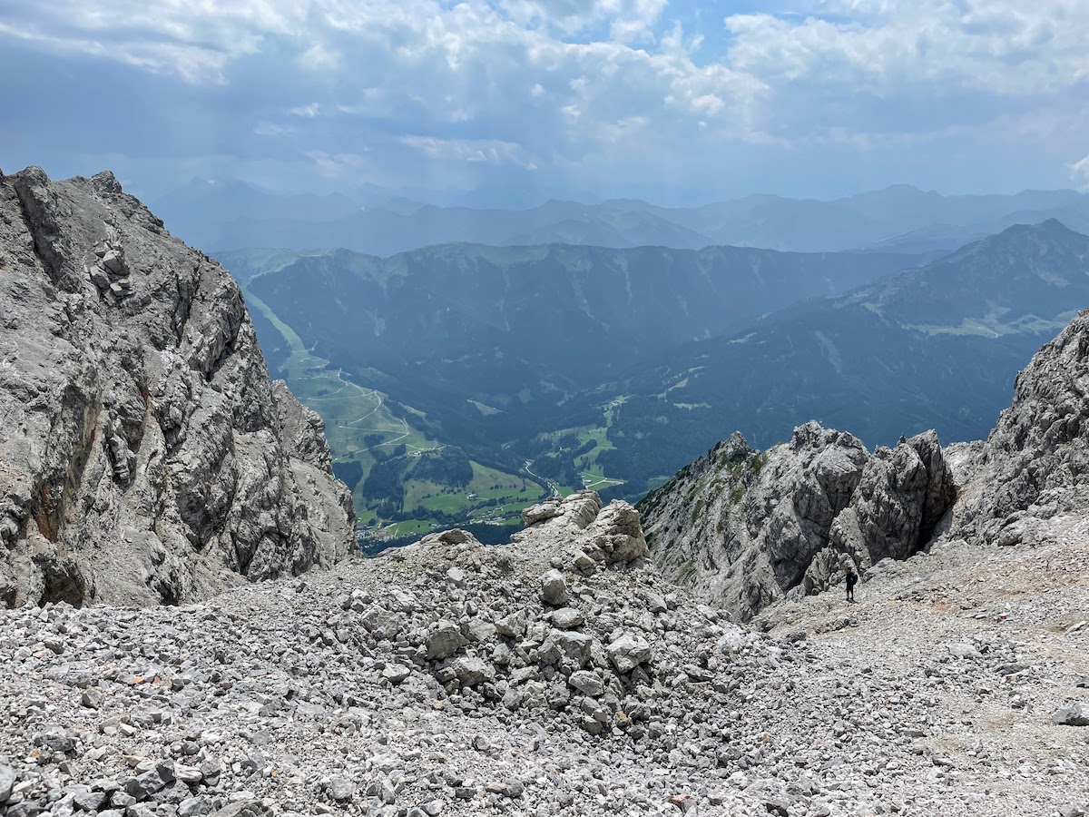
A long descent on loose gravel
The clouds rolled in and it started to rain. And we kept going down and down. We had to descend 1,700 meters, which is a lot. It seemed this descent would never end. We really wanted to sit down and rest. Volchiy found a little spot under a tree where we could at least hide from the rain a bit and make some tea. After tea with cookies, our strength returned. At last the terrible loose scree ended, and the trail became gentler.
Finally, a gentle trail
The rain stopped. Cows and mountain farms appeared. We descended into the village. But there were still at least 3 km through the forest to our parking spot. Volchiy suggested leaving me behind and going light, without a backpack, to get the car himself. As it turned out later, this was a very good decision. Without me, Volchiy walked briskly for 40 minutes to the car. And with me, it would have taken exactly twice as long.
Farm and Mountains
We were somewhere up there at the very top of these mountains. I stood there, looking up at this mountain range from below, and I couldn’t believe it — I had been there, at the very top!
And what’s also interesting is that during the whole time we didn’t meet a single person.... Completely alone all day along the entire route...